The NSF-NNA sponsored activity focused on developing a co-production framework for addressing multiple changing environmental hazards.
What are Scenarios?
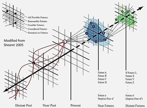
Scenarios investigate possible futures with each scenario-based on assumptions of possible change. The figure below helps show how scenarios can create a distribution of possible futures. The darker colors highlight the potential expanse identified by participants.
Why do scenarios?
In the process participants can become more aware of uncertainties and in the process of identifying potential futures begin to make adaptive plans.
For more about the scenario process please visit our scenario section.
Below are some of the products and results from our research project.
21 August 2023
In this paper we modified an existing landcover dataset to better identify vegetation associated with wildfire and permafrost in Fairbanks, Anchorage, and Whitehorse over the past 4 decades (1984-2014) and make predictions for the next 4 decades (2024-2054). We used an existing fire model called FlamMap and several statistical analyses to determine where future fires could be possible. Being able to see how the landscape and vegetation change through time allows us to better understand current and future permafrost distributions and wildfire hazards which are essential to developing community plans that reduce risk and increase preparedness for natural hazards.


As regional temperatures change, permafrost, ground that is perennially frozen for two or more years, is thawing and negatively impacting homes, infrastructure, and agriculture.

Wildfire is a major danger in each community as they all have residents and infrastructure in or nearby forested areas.
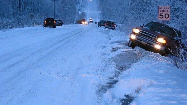
Rain-in-winter events are becoming more common in the arctic. These events cause economic and personal loss for business and families in the affected areas.